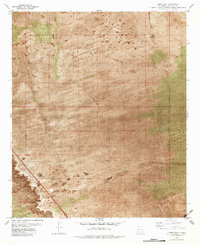
1982 Map of Thorn Well
USGS Topo · Published 1982About this map
Water management dominates this arid landscape in Doña Ana County, where scattered tanks and wells provide essential infrastructure for ranching and exploration. The orthophotomosaic base reveals the sparse vegetation and wind-scoured terrain typical of the region in the early 1980s. Key water sources like Caliche Tank and Thorn Well serve as central landmarks in an area primarily defined by section lines and the New Mexico Principal Meridian. Evidence of resource prospecting is visible through multiple locations identified simply as Drill Hole or Drill Hole South Well, scattered across the desert floor. The network of transportation is rudimentary, consisting largely of a Jeep Trail that navigates the basins between low rises, connecting remote points such as Lake Tank and Detroit Tank. This survey reflects the persistence of traditional land use in a region where survival is tied directly to these man-made catchments and deep wells.
Find a feature on this map
8 named features on this map. Tap any name to fly to it.
Don’t see what you’re looking for? This feature index may not catch every label — zoom into the map to look around manually.
Map Details
Editions of this 1982 Thorn Well Map
This is the sole edition of this map. No revisions or reprints were ever made.
Other maps of this area

1916 · Tonuco
USGS Topo · 1:125,000

1932 · Tonuco
USGS Topo · 1:125,000

1948 · Chicken Well
USGS Topo · 1:62,500

1948 · San Diego Mountain
USGS Topo · 1:62,500

1955 · Las Cruces
USGS Topo · 1:250,000

1958 · Las Cruces
USGS Topo · 1:250,000
1959 · Sierra Alta
USGS Topo · 1:24,000

1959 · Rincon
USGS Topo · 1:24,000

1959 · Upham
USGS Topo · 1:62,500

1981 · Gilmore Draw
USGS Topo · 1:24,000