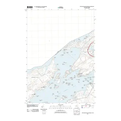
2011 Map of Thousand Island Park
USGS Topo · Published 2011About this map
Thousand Island Park serves as a central hub in this intricate survey of the Saint Lawrence River archipelago. Spanning the international boundary between New York and Ontario, the landscape is defined by its extensive collection of islands, including the large landmasses of Grindstone Island and Wellesley Island. The map documents a dense network of seasonal and year-round settlements such as Fineview, Grandview Park, and Fishers Landing. Historical transit points are clearly marked, with Lower Town Landing and Upper Town Landing providing critical access to the interior of the islands. The geography is further complicated by numerous smaller formations like the Robinson Group and Eagle Wing Group, while narrow water passages such as the American Narrows indicate the primary shipping channels used by vessels navigating through the heart of the Thousand Island Park quadrangle.
Find a feature on this map
87 named features on this map. Tap any name to fly to it.
Don’t see what you’re looking for? This feature index may not catch every label — zoom into the map to look around manually.
Map Details
Editions of this 2011 Thousand Island Park Map
This is the sole edition of this map. No revisions or reprints were ever made.
Other maps of this area

1900 · Clayton
USGS Topo · 1:62,500

1903 · Grindstone
USGS Topo · 1:62,500

1903 · Clayton
USGS Topo · 1:62,500

1903 · Alexandria Bay
USGS Topo · 1:62,500

1903 · Theresa
USGS Topo · 1:62,500

1942 · Sawmill Bay
USGS Topo · 1:31,680

1942 · Clayton
USGS Topo · 1:24,000

1943 · Thousand Island Park
USGS Topo · 1:31,680

1943 · Clayton
USGS Topo · 1:31,680

1943 · Lafargeville
USGS Topo · 1:31,680