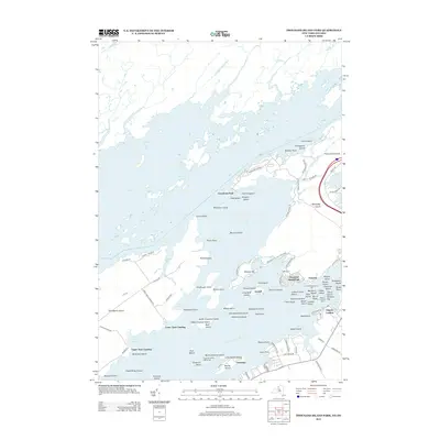
2013 Map of Thousand Island Park
USGS Topo · Published 2013About this map
Thousand Islands cluster together within the Saint Lawrence River, defining a landscape of complex waterways and seasonal communities. This 2013 survey details the recreational and residential character of the region, from the Victorian-era roots of Thousand Island Park to the expansive Wellesley Island State Park. The map reveals a dense network of private landings and islands, including Grindstone Island and Picton Island, which have long served as summer retreats. Marine navigation is clearly marked by the Chapman Shoal Lighthouse and Granite State Shoal Light, highlighting the importance of the river channel to the local economy. On the mainland, Fishers Landing serves as a primary access point, while smaller settlements like Fineview and Grandview Park line the shores of Wellesley Island.
Find a feature on this map
109 named features on this map. Tap any name to fly to it.
Don’t see what you’re looking for? This feature index may not catch every label — zoom into the map to look around manually.
Map Details
Editions of this 2013 Thousand Island Park Map
This is the sole edition of this map. No revisions or reprints were ever made.
Other maps of this area

1900 · Clayton
USGS Topo · 1:62,500

1903 · Grindstone
USGS Topo · 1:62,500

1903 · Clayton
USGS Topo · 1:62,500

1903 · Alexandria Bay
USGS Topo · 1:62,500

1903 · Theresa
USGS Topo · 1:62,500

1942 · Sawmill Bay
USGS Topo · 1:31,680

1942 · Clayton
USGS Topo · 1:24,000

1943 · Thousand Island Park
USGS Topo · 1:31,680

1943 · Clayton
USGS Topo · 1:31,680

1943 · Lafargeville
USGS Topo · 1:31,680