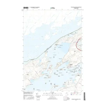
2016 Map of Thousand Island Park
USGS Topo · Published 2016About this map
Wellesley Island dominates this section of the Saint Lawrence River, bisected by the international boundary between New York and Canada. The map illustrates a densely populated riverine landscape, where historic summer colonies like Thousand Island Park and Grandview Park are reached by a network of local roads such as Thousand Island Park Rd and Nature Center Rd. The intricate shoreline of the Lake of the Isles and Eel Bay highlights the complex geography that made this region a prominent seasonal destination.
Find a feature on this map
110 named features on this map. Tap any name to fly to it.
Don’t see what you’re looking for? This feature index may not catch every label — zoom into the map to look around manually.
Map Details
Editions of this 2016 Thousand Island Park Map
This is the sole edition of this map. No revisions or reprints were ever made.
Other maps of this area

1900 · Clayton
USGS Topo · 1:62,500

1903 · Grindstone
USGS Topo · 1:62,500

1903 · Clayton
USGS Topo · 1:62,500

1903 · Alexandria Bay
USGS Topo · 1:62,500

1903 · Theresa
USGS Topo · 1:62,500

1942 · Sawmill Bay
USGS Topo · 1:31,680

1942 · Clayton
USGS Topo · 1:24,000

1943 · Thousand Island Park
USGS Topo · 1:31,680

1943 · Clayton
USGS Topo · 1:31,680

1943 · Lafargeville
USGS Topo · 1:31,680