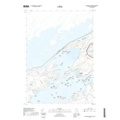
2019 Map of Thousand Island Park
USGS Topo · Published 2019About this map
The Saint Lawrence River serves as a sprawling aquatic landscape where the international boundary separates New York from Ontario. This map centers on the dense archipelago of the Thousand Islands, characterized by major landforms such as Grindstone Island and Wellesley Island State Park. The settlement of Thousand Island Park is a prominent focal point on the southern shore of Wellesley Island, appearing alongside smaller communities like Fineview and Grandview Park. The geography is defined by a complex network of bays and channels, including the American Narrows and the Lake of the Isles. Numerous smaller island clusters like the Robinson Group and Eagle Wing Group illustrate the intricate maritime environment. Grounded in 2019 data, the map details a mix of established island residences and protected natural areas like Whitehouse Marsh.
Find a feature on this map
99 named features on this map. Tap any name to fly to it.
Don’t see what you’re looking for? This feature index may not catch every label — zoom into the map to look around manually.
Map Details
Editions of this 2019 Thousand Island Park Map
This is the sole edition of this map. No revisions or reprints were ever made.
Other maps of this area

1900 · Clayton
USGS Topo · 1:62,500

1903 · Grindstone
USGS Topo · 1:62,500

1903 · Clayton
USGS Topo · 1:62,500

1903 · Alexandria Bay
USGS Topo · 1:62,500

1903 · Theresa
USGS Topo · 1:62,500

1942 · Sawmill Bay
USGS Topo · 1:31,680

1942 · Clayton
USGS Topo · 1:24,000

1943 · Thousand Island Park
USGS Topo · 1:31,680

1943 · Clayton
USGS Topo · 1:31,680

1943 · Lafargeville
USGS Topo · 1:31,680