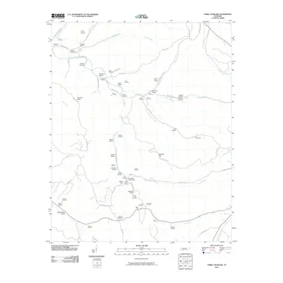
2010 Map of Three Churches
USGS Topo · Published 2010About this map
Three Churches serves as the focal point for this rural Wayne County landscape, where a dense network of family cemeteries and named hollows reveals a deeply rooted community structure. The map detail reflects a history of small-scale settlement along the drainages of Indian Creek and Roanoke Creek. Genealogists will find a significant concentration of burial sites, including the Masonic Hall Cemetery, Horton Family Cemetery, and the Cypert-Thornton Cemetery. This 2010 data preservation captures the persistence of traditional land names like Slaughter Pen Hollow and Schoolhouse Hollow, even as modern infrastructure like Land Fill Rd appears. The geography is defined by the winding paths of Rayburn Creek and Chalk Creek, with intersections such as Cromwell Crossroads marking local transit points in this wooded Tennessee terrain.
Find a feature on this map
75 named features on this map. Tap any name to fly to it.
Don’t see what you’re looking for? This feature index may not catch every label — zoom into the map to look around manually.
Map Details
Editions of this 2010 Three Churches Map
This is the sole edition of this map. No revisions or reprints were ever made.
Other maps of this area

1905 · Waynesboro
USGS Topo · 1:125,000

1936 · Collinwood
USGS Topo · 1:24,000

1936 · Eagle Creek
USGS Topo · 1:24,000

1936 · Light
USGS Topo · 1:24,000

1936 · Negro Hollow
USGS Topo · 1:24,000

1936 · Cypress Inn
USGS Topo · 1:24,000

1936 · Three Churches
USGS Topo · 1:24,000

1936 · Ransom Stand
USGS Topo · 1:24,000

1936 · Waynesboro
USGS Topo · 1:24,000

1936 · Martins Mills
USGS Topo · 1:24,000