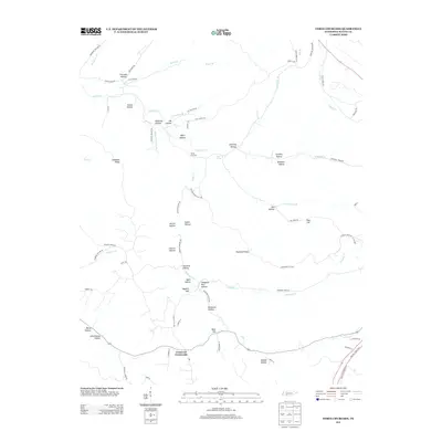
2013 Map of Three Churches
USGS Topo · Published 2013About this map
Indian Cr and its many winding tributaries define the topography of this Wayne County landscape, where narrow valleys and ridges dictated the placement of small rural communities. The settlement of Three Churches sits centrally near Cave Spring, while Cromwell Crossroads marks a key junction further south along the ridge. The map reveals a high density of named hollows, such as Slaughter Pen Hollow and Newburn Hollow, which speak to the area's agricultural and homesteading history. Transportation follows the natural drainage patterns, with roads like Roanoke Creek Rd and Robinson Hollow Rd tracing the low ground between hills. Religious and educational history is anchored by Baptist Hill and the appropriately named Schoolhouse Hollow, providing valuable reference points for genealogists researching family lineages tied to these specific Wayne County landmarks.
Find a feature on this map
80 named features on this map. Tap any name to fly to it.
Don’t see what you’re looking for? This feature index may not catch every label — zoom into the map to look around manually.
Map Details
Editions of this 2013 Three Churches Map
This is the sole edition of this map. No revisions or reprints were ever made.
Other maps of this area

1905 · Waynesboro
USGS Topo · 1:125,000

1936 · Collinwood
USGS Topo · 1:24,000

1936 · Eagle Creek
USGS Topo · 1:24,000

1936 · Light
USGS Topo · 1:24,000

1936 · Negro Hollow
USGS Topo · 1:24,000

1936 · Cypress Inn
USGS Topo · 1:24,000

1936 · Three Churches
USGS Topo · 1:24,000

1936 · Ransom Stand
USGS Topo · 1:24,000

1936 · Waynesboro
USGS Topo · 1:24,000

1936 · Martins Mills
USGS Topo · 1:24,000