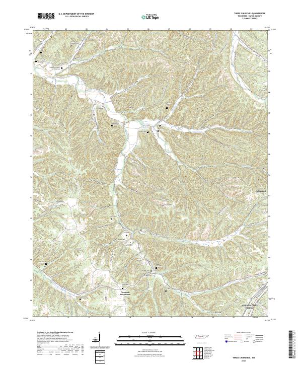
2022 Map of Three Churches
USGS Topo · Published 2022About this map
Cromwell Crossroads and the outskirts of Collinwood anchor this landscape of deeply incised hollows and ridges in Wayne County. The terrain is defined by an intricate network of narrow valleys such as Lay Hollow, Downing Hollow, and Owl Hollow, where small family cemeteries are frequently tucked away. These burial grounds, including the Cypert-Thornton Cem and Horton Family Cem, offer significant genealogical value, often situated near original family homesteads or along old routes like Old Hog Creek Rd.
Find a feature on this map
83 named features on this map. Tap any name to fly to it.
Don’t see what you’re looking for? This feature index may not catch every label — zoom into the map to look around manually.
Map Details
Editions of this 2022 Three Churches Map
This is the sole edition of this map. No revisions or reprints were ever made.
Other maps of this area

1905 · Waynesboro
USGS Topo · 1:125,000

1936 · Collinwood
USGS Topo · 1:24,000

1936 · Eagle Creek
USGS Topo · 1:24,000

1936 · Light
USGS Topo · 1:24,000

1936 · Negro Hollow
USGS Topo · 1:24,000

1936 · Cypress Inn
USGS Topo · 1:24,000

1936 · Three Churches
USGS Topo · 1:24,000

1936 · Ransom Stand
USGS Topo · 1:24,000

1936 · Waynesboro
USGS Topo · 1:24,000

1936 · Martins Mills
USGS Topo · 1:24,000