
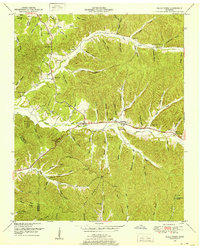
1936 Map of Three Churches
USGS Topo · Published 1936About this map
Indian Creek and its many winding tributaries like Chalk Creek and Roanoke Creek carve through this rural Wayne County landscape, which was surveyed by the Tennessee Valley Authority and USGS in 1936. This era of the Great Depression saw the region transitioning toward modern infrastructure, though local life remained centered around small settlements like Three Churches and the community of Victory. The settlement pattern follows the drainage network, with homes and institutions established along the narrow hollows and creek banks.
Find a feature on this map
33 named features on this map. Tap any name to fly to it.
Don’t see what you’re looking for? This feature index may not catch every label — zoom into the map to look around manually.
Map Details
Editions of this 1936 Three Churches Map
This is the sole edition of this map. No revisions or reprints were ever made.
Other maps of this area

1905 · Waynesboro
USGS Topo · 1:125,000

1936 · Collinwood
USGS Topo · 1:24,000

1936 · Eagle Creek
USGS Topo · 1:24,000

1936 · Light
USGS Topo · 1:24,000

1936 · Negro Hollow
USGS Topo · 1:24,000

1936 · Cypress Inn
USGS Topo · 1:24,000

1936 · Ransom Stand
USGS Topo · 1:24,000

1936 · Waynesboro
USGS Topo · 1:24,000

1936 · Martins Mills
USGS Topo · 1:24,000
1949 · Eagle Creek
USGS Topo · 1:24,000