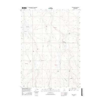
2017 Map of Three Creek
USGS Topo · Published 2017About this map
Three Creek serves as a central point in this remote Owyhee County landscape, where the high desert meets a complex system of seasonal drainages and basaltic formations. The terrain is defined by dramatic geological markers such as Black Rock and Castle Rock, which overlook the expansive Beaver Flat and Joiner Flat. This 2017 survey details a network of ranching and access roads, including Three Creek Rd and Elk Mountain Rd, which navigate the winding canyons and draws. Water is the primary sculptor here, with Big Flat Cr and Little Spring Cr feeding into the wider watershed. The southern reach of the map transitions into the Inside Desert, while the eastern portion is dominated by the steep descents of Hays Canyon and the notable Mud Flat area. This document captures the modern state of these high-altitude pastures and the critical water sources that sustain the region's livestock traditions.
Find a feature on this map
32 named features on this map. Tap any name to fly to it.
Don’t see what you’re looking for? This feature index may not catch every label — zoom into the map to look around manually.
Map Details
Editions of this 2017 Three Creek Map
This is the sole edition of this map. No revisions or reprints were ever made.
Other maps of this area

1943 · Jarbidge
USGS Topo · 1:62,500

1945 · Jarbidge
USGS Topo · 1:62,500

1955 · Twin Falls
USGS Topo · 1:250,000

1955 · Wells
USGS Topo · 1:250,000

1957 · Elk Mountain
USGS Topo · 1:62,500

1958 · Wells
USGS Topo · 1:250,000

1958 · Twin Falls
USGS Topo · 1:250,000

1961 · Wells
USGS Topo · 1:250,000

1979 · Salls Crossing
USGS Topo · 1:24,000

1979 · Mosquito Lake Butte
USGS Topo · 1:24,000