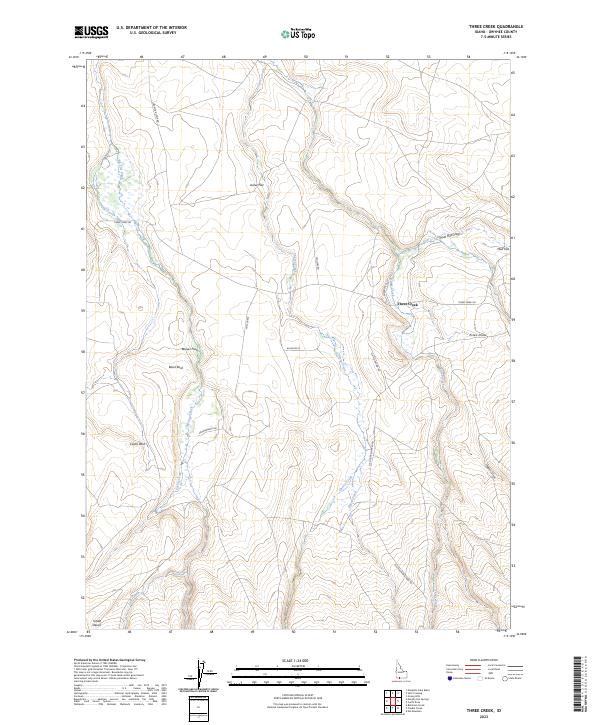
2023 Map of Three Creek
USGS Topo · Published 2023About this map
Three Creek serves as a central reference point in this high-desert Owyhee County landscape, where the confluence of seasonal watercourses and expansive flats defines the local geography. The settlement at Mud Flat and the surrounding drainages like Mud Flat Draw and Estes Draw illustrate how land usage in this part of Idaho has long been shaped by the availability of water. Topographic landmarks such as Castle Rock, Black Rock, and the edge of the Inside Desert provide distinct navigational markers across the plateau. The map details a network of rural routes including Three Creek Rd and Elk Mountain Rd, which connect the isolated homesteads and grazing lands. From Joiner Flat to Beaver Flat, the terrain transitions between open sagebrush plains and the deeply cut channels of Cherry Creek and Hayes Creek, offering a contemporary look at this enduring ranching corridor.
Find a feature on this map
32 named features on this map. Tap any name to fly to it.
Don’t see what you’re looking for? This feature index may not catch every label — zoom into the map to look around manually.
Map Details
Editions of this 2023 Three Creek Map
This is the sole edition of this map. No revisions or reprints were ever made.
Other maps of this area

1943 · Jarbidge
USGS Topo · 1:62,500

1945 · Jarbidge
USGS Topo · 1:62,500

1955 · Twin Falls
USGS Topo · 1:250,000

1955 · Wells
USGS Topo · 1:250,000

1957 · Elk Mountain
USGS Topo · 1:62,500

1958 · Wells
USGS Topo · 1:250,000

1958 · Twin Falls
USGS Topo · 1:250,000

1961 · Wells
USGS Topo · 1:250,000

1979 · Salls Crossing
USGS Topo · 1:24,000

1979 · Mosquito Lake Butte
USGS Topo · 1:24,000