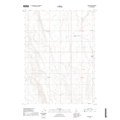
2020 Map of Three Forks
USGS Topo · Published 2020About this map
Three Forks sits at a high-elevation drainage confluence in the southwest corner of Idaho, where the high desert plateau is carved by an intricate network of seasonal creeks. The landscape is defined by the hydrologic importance of isolated water sources like Watchabob Springs, Three Forks Summit Springs, and Chicken Spring, which likely served as critical landmarks for early travel and livestock. These springs are connected by a network of historic tracks and Bureau of Indian Affairs routes, including 211 Bia and 210 Bia. The presence of grazing-related place names such as Indian Hay Meadows and Three Forks Meadow suggests a history of ranching and forage in this arid environment. Significant drainage systems like Marys Cr, Miller Cr, and Bell Cr cut through the terrain, leading toward the Mud Flats and Harris Lake in the north, illustrating the complex watershed of Owyhee County.
Find a feature on this map
29 named features on this map. Tap any name to fly to it.
Don’t see what you’re looking for? This feature index may not catch every label — zoom into the map to look around manually.
Map Details
Editions of this 2020 Three Forks Map
This is the sole edition of this map. No revisions or reprints were ever made.
Other maps of this area

1936 · Mountain City
USGS Topo · 1:62,500

1939 · Owyhee
USGS Topo · 1:62,500

1940 · Mountain City
USGS Topo · 1:62,500

1942 · Owyhee
USGS Topo · 1:62,500

1955 · McDermitt
USGS Topo · 1:250,000

1955 · Jordan Valley
USGS Topo · 1:250,000

1955 · Twin Falls
USGS Topo · 1:250,000

1955 · Wells
USGS Topo · 1:250,000

1957 · Jordan Valley
USGS Topo · 1:250,000

1958 · Wells
USGS Topo · 1:250,000