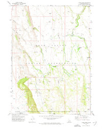
1971 Map of Three Forks
USGS Topo · Published 1974About this map
The Duck Valley Indian Reservation occupies the central portion of this high-desert landscape on the border of Idaho and Nevada. Surveyed in the early 1970s, the terrain is defined by a complex network of seasonal watercourses and spring-fed basins, including Marys Creek, Miller Creek, and Papoose Creek. The mapping reveals a remote rangeland where name-places like Cranes Nest and Three Forks Meadow indicate vital water sources in an otherwise arid environment. Human presence is documented primarily through primitive transportation routes such as the Damon Trail and Ryegrass Trail, which follow the natural contours of the drainages. These trails and numerous named springs, such as Watchabob Springs and Chicken Spring, provide a record of land use and navigation in Owyhee Co and Elko Co prior to modern development.
Find a feature on this map
28 named features on this map. Tap any name to fly to it.
Don’t see what you’re looking for? This feature index may not catch every label — zoom into the map to look around manually.
Map Details
Editions of this 1971 Three Forks Map
This is the sole edition of this map. No revisions or reprints were ever made.
Other maps of this area

1936 · Mountain City
USGS Topo · 1:62,500

1939 · Owyhee
USGS Topo · 1:62,500

1940 · Mountain City
USGS Topo · 1:62,500

1942 · Owyhee
USGS Topo · 1:62,500

1955 · McDermitt
USGS Topo · 1:250,000

1955 · Jordan Valley
USGS Topo · 1:250,000

1955 · Twin Falls
USGS Topo · 1:250,000

1955 · Wells
USGS Topo · 1:250,000

1957 · Jordan Valley
USGS Topo · 1:250,000

1958 · Wells
USGS Topo · 1:250,000