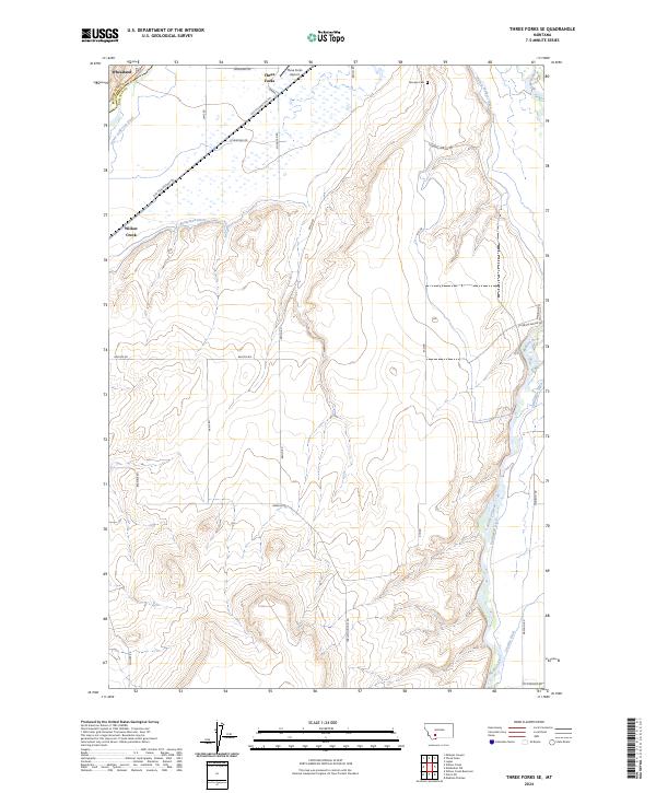
2024 Map of Three Forks SE
USGS Topo · Published 2024About this map
The Madison River flows through the eastern edge of this landscape, its waters diverted by an intricate network of irrigation channels including the Darlington Ditch, Francis Walbert Ditch, and Crowley Ditch. This reliance on water management is further evidenced by the Lower Jefferson Ditch and Buttleman Ditch in the western reaches, supporting the agricultural communities of Wheatland and Willow Creek. The transportation corridor is anchored by the Old Yellowstone Trl and Three Forks Airport, reflecting both historical trail routes and modern aviation infrastructure. Local family history is centered near the Fairview Cem, while the county line between Broadwater and Gallatin counties cuts across the northwest corner. This modern survey illustrates how traditional western ranching and water rights continue to shape the geographic footprint of this region south of the headwaters.
Find a feature on this map
33 named features on this map. Tap any name to fly to it.
Don’t see what you’re looking for? This feature index may not catch every label — zoom into the map to look around manually.
Map Details
Editions of this 2024 Three Forks SE Map
This is the sole edition of this map. No revisions or reprints were ever made.
Other maps of this area

1888 · Three Forks
USGS Topo · 1:250,000

1894 · Three Forks
USGS Topo · 1:250,000

1895 · Three Forks
USGS Topo · 1:250,000

1947 · Bozeman
USGS Topo · 1:250,000

1948 · Bozeman
USGS Topo · 1:250,000

1949 · Anceney
USGS Topo · 1:62,500

1949 · Manhattan
USGS Topo · 1:62,500

1949 · Norris
USGS Topo · 1:62,500

1950 · Three Forks
USGS Topo · 1:62,500

1951 · Norris
USGS Topo · 1:62,500