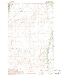
1987 Map of Three Forks SE
USGS Topo · Published 1987About this map
The Jefferson River and Madison River define the hydraulic character of this Gallatin County landscape in the late 1980s. This survey illustrates an intricate system of water management essential to the region's agricultural and industrial utility, featuring an Aqueduct, various instances of a Ditch, and a Dike or Levee system along the riverbanks. Local family names and early transit routes are preserved through labels like Buttleman, Walbert, and Darlington.
Find a feature on this map
23 named features on this map. Tap any name to fly to it.
Don’t see what you’re looking for? This feature index may not catch every label — zoom into the map to look around manually.
Map Details
Editions of this 1987 Three Forks SE Map
This is the sole edition of this map. No revisions or reprints were ever made.
Other maps of this area

1888 · Three Forks
USGS Topo · 1:250,000

1894 · Three Forks
USGS Topo · 1:250,000

1895 · Three Forks
USGS Topo · 1:250,000

1947 · Bozeman
USGS Topo · 1:250,000

1948 · Bozeman
USGS Topo · 1:250,000

1949 · Anceney
USGS Topo · 1:62,500

1949 · Manhattan
USGS Topo · 1:62,500

1949 · Norris
USGS Topo · 1:62,500

1950 · Three Forks
USGS Topo · 1:62,500

1951 · Norris
USGS Topo · 1:62,500