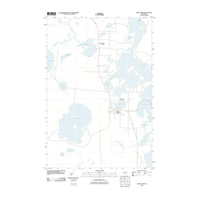
2010 Map of Three Lakes
USGS Topo · Published 2010About this map
Three Lakes and the adjacent settlement of Clearwater Lake anchor this map of the lake-strewn Wisconsin Northwoods. The landscape is defined by its extensive hydrography, where massive water bodies like Thunder Lake and Spirit Lake are connected by a network of small streams including Mud Creek and Mosquito Creek. This 2010 survey illustrates the balance between seasonal recreational outposts like Honey Rock Camp and infrastructure like the Maple Lake 2WP487 Dam. The southern reaches of the map show the wetlands surrounding Hutchinson Lake and Cook Lake, while the western edge is dominated by the sprawling waters of Columbus Lake. Local history researchers will find the specific road alignments and residential clusters surrounding Maple Lake particularly useful for tracking modern development around these traditional glacial lakes.
Find a feature on this map
24 named features on this map. Tap any name to fly to it.
Don’t see what you’re looking for? This feature index may not catch every label — zoom into the map to look around manually.
Map Details
Editions of this 2010 Three Lakes Map
This is the sole edition of this map. No revisions or reprints were ever made.
Other maps of this area

1928 · Three Lakes
USGS Topo · 1:48,000

1930 · Robbins
USGS Topo · 1:48,000

1938 · Three Lakes
USGS Topo · 1:48,000

1938 · Robbins
USGS Topo · 1:48,000

1940 · Monico
USGS Topo · 1:48,000

1940 · Rhinelander
USGS Topo · 1:48,000

1945 · Three Lakes
USGS Topo · 1:48,000

1945 · Robbins
USGS Topo · 1:48,000

1949 · Rhinelander
USGS Topo · 1:48,000

1950 · Monico
USGS Topo · 1:48,000