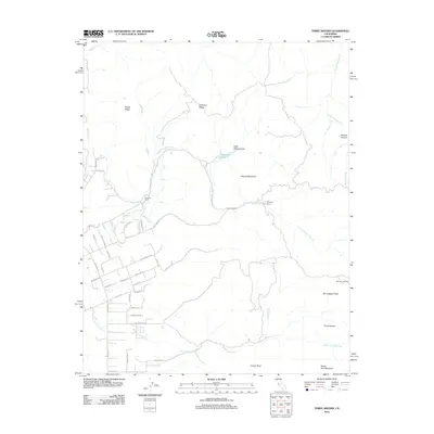
2012 Map of Three Sisters
USGS Topo · Published 2012About this map
Hawkins Ranch and Garcia Rancho anchor a landscape defined by significant topographic elevations and seasonal watercourses in this high-resolution study. The terrain is marked by prominent summits such as San Joaquin Peak and the namesake Three Sisters to the east, while Coyote Peak and Santa Ana Mountain dominate the southern reaches. This area shows a transition from the structured residential street patterns in the southwest—including Fallon Rd and Fairview Rd—to the open ranch lands and ridges further north. Drainage patterns are complex, with Arroyo De Las Viboras and Arroyo Dos Picachos cutting through the valleys. The map documents the enduring footprint of historic land grants and family holdings like Sparling Ranch and Rancho Las Cimas, preserving the spatial relationship between early agricultural estates and the modern road network.
Find a feature on this map
47 named features on this map. Tap any name to fly to it.
Don’t see what you’re looking for? This feature index may not catch every label — zoom into the map to look around manually.
Map Details
Editions of this 2012 Three Sisters Map
This is the sole edition of this map. No revisions or reprints were ever made.
Other maps of this area

1919 · Hollister
USGS Topo · 1:48,000

1920 · Pacheco Pass
USGS Topo · 1:62,500

1921 · Gilroy Hot Springs
USGS Topo · 1:62,500

1921 · Hollister
USGS Topo · 1:62,500

1922 · Quien Sabe
USGS Topo · 1:62,500

1923 · Hollister
USGS Topo · 1:62,500

1939 · Gilroy Hot Springs
USGS Topo · 1:62,500

1940 · Gilroy Hot Springs
USGS Topo · 1:62,500

1940 · Hollister
USGS Topo · 1:62,500

1940 · Pacheco Pass
USGS Topo · 1:62,500