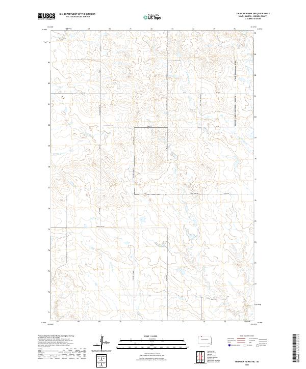
2021 Map of Thunder Hawk SW
USGS Topo · Published 2021About this map
Deer Cr and Cyclone Cr weave through the open plains of Corson County in this contemporary look at the western South Dakota landscape. The terrain is defined by its section-line road network and drainage systems, where W Br Willow Cr and Willow Cr meet the expansive ranchlands. The map reveals a remote infrastructure dominated by utilitarian access, including the primary north-south Thunder Hawk Rd and Lemon Lake Rd. Notable for researchers and land managers are the various non-standard transit routes such as the 210th (Jeep Trail) Ave and the 110th 4wd Trl, which indicate the practical challenges of traversing this grassland environment. This modern survey reflects the enduring grid-based settlement patterns and the vital importance of seasonal watercourses in a dry, agricultural region.
Find a feature on this map
23 named features on this map. Tap any name to fly to it.
Don’t see what you’re looking for? This feature index may not catch every label — zoom into the map to look around manually.
Map Details
Editions of this 2021 Thunder Hawk SW Map
This is the sole edition of this map. No revisions or reprints were ever made.
Other maps of this area

1953 · McIntosh
USGS Topo · 1:250,000

1954 · Lemmon
USGS Topo · 1:250,000

1957 · Lemmon
USGS Topo · 1:250,000

1958 · McIntosh
USGS Topo · 1:250,000

1972 · Black Horse Butte NW
USGS Topo · 1:24,000

1972 · Thunder Hawk SW
USGS Topo · 1:24,000

1972 · Thunder Hawk SE
USGS Topo · 1:24,000
1972 · Keldron
USGS Topo · 1:24,000
1972 · Thunder Hawk
USGS Topo · 1:24,000

1972 · Black Horse Butte NE
USGS Topo · 1:24,000