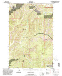
1995 Map of Thunder Mountain
USGS Topo · Published 1997About this map
The Little Belt Mountains define this high-altitude section of the Lewis and Clark National Forest, where the landscape is carved by an intricate network of drainages. The Kings Hill Ranger District manages this area, which is anchored by the prominent peaks of Thunder Mountain and Big Horn Mountain. The map reveals a history of resource exploration, indicated by several prospects scattered near the headwaters of Spring Creek and across the ridgelines. Movement through the steep terrain is facilitated by primitive routes like the Circle Trail, while the deep cuts of Tobins Gulch, Goblin Gulch, and Holter Gulch illustrate the erosive power of the local watershed. This 1995 revision provides a clear record of the boundary between Cascade and Meagher counties as it crosses these summits, showing the land just as it remained before modern digital mapping updates.
Find a feature on this map
21 named features on this map. Tap any name to fly to it.
Don’t see what you’re looking for? This feature index may not catch every label — zoom into the map to look around manually.
Map Details
Editions of this 1995 Thunder Mountain Map
This is the sole edition of this map. No revisions or reprints were ever made.
Other maps of this area

1886 · Great Falls
USGS Topo · 1:250,000

1886 · Fort Logan
USGS Topo · 1:250,000

1886 · Little Belt Mts.
USGS Topo · 1:250,000

1890 · Fort Benton
USGS Topo · 1:250,000

1892 · Fort Benton
USGS Topo · 1:250,000

1894 · Little Belt Mts.
USGS Topo · 1:250,000

1897 · Fort Benton
USGS Topo · 1:250,000

1897 · Little Belt Mts.
USGS Topo · 1:250,000

1898 · Little Belt Mts.
USGS Topo · 1:250,000

1902 · Little Belt Mts.
USGS Topo · 1:250,000