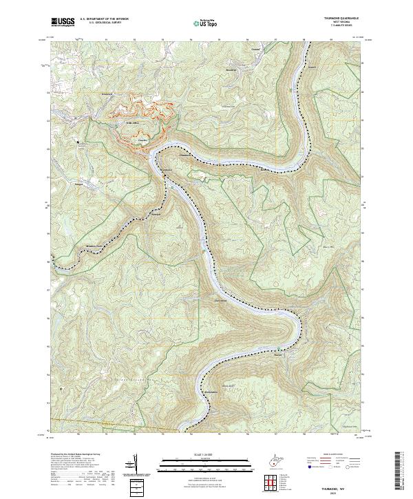
2023 Map of Thurmond
USGS Topo · Published 2023About this map
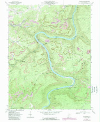
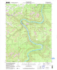
New River Gorge National River dominates this topographical portrait of the central New River canyon. The CSX rail line follows the river's winding course, serving a series of settlements built into the narrow benchlands and hillsides, including the historic railroad hub of Thurmond and the river towns of McKendree, Thayer, and Claremont. The terrain is defined by steep elevation changes from the water's edge at Silo Rapids and Surprise Rapids up to the high plateaus of Garden Ground Mtn and Beury Mtn.
Find a feature on this map
102 named features on this map. Tap any name to fly to it.
Don’t see what you’re looking for? This feature index may not catch every label — zoom into the map to look around manually.
Map Details
Editions of this 2023 Thurmond Map
This is the sole edition of this map. No revisions or reprints were ever made.
Historical Maps of Alpha Base Camp Through Time
3 maps found