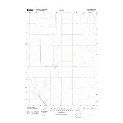
2011 Map of Thurston
USGS Topo · Published 2011About this map
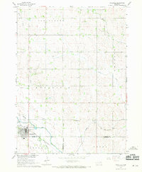
Thurston serves as the central hub of this agricultural landscape in northeastern Nebraska, where the local Thurston Post Office anchors the townsite along State Hwy Spur S-87A. The terrain is defined by an intricate drainage system including Middle Creek, Cow Creek, and Big Slough Creek, which wind through the township grids. Of particular note is the Logan Creek Dredge in the southwest corner, reflecting significant hydraulic engineering and land management efforts to channelize local waterways. This 2011 survey also details the rural road network, including uniquely named routes like The Strip Rd and Thurston Rd, which connect the dispersed farmsteads of the region. The map provides a clear look at the intersection of natural hydrology, such as Rattlesnake Creek, and the human-made grid system that organizes this corner of Thurston County.
Find a feature on this map
15 named features on this map. Tap any name to fly to it.
Don’t see what you’re looking for? This feature index may not catch every label — zoom into the map to look around manually.
Map Details
Editions of this 2011 Thurston Map
This is the sole edition of this map. No revisions or reprints were ever made.
Other maps of this area

1955 · Sioux City
USGS Topo · 1:250,000

1958 · Sioux City
USGS Topo · 1:250,000

1959 · Sioux City
USGS Topo · 1:250,000
1966 · Bancroft
USGS Topo · 1:24,000

1966 · Thurston
USGS Topo · 1:24,000
1966 · Altona SE
USGS Topo · 1:24,000

1966 · Altona NE
USGS Topo · 1:24,000

1966 · Pender NE
USGS Topo · 1:24,000
1966 · Pender
USGS Topo · 1:24,000
1967 · Wakefield
USGS Topo · 1:24,000