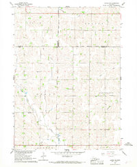
1966 Map of Altona SE
USGS Topo · Published 1968About this map
The Omaha Indian Reservation Boundary bisects this mid-1960s landscape, marking a significant cartographic divide between Wayne, Thurston, and Cuming counties. The agricultural character of the era is defined by a dense network of section lines and township boundaries, including Leslie, Thayer, Grant, and Cleveland. This survey captures the rural educational infrastructure before widespread district consolidation, preserving the locations of numerous country schools such as School No 4, School No 67, School No 66, and School No 82. Waterways like Rattlesnake Creek and Plum Creek meander through the undulating terrain, while the Old Indian Treaty Boundary serves as a reminder of earlier territorial divisions. A single spiritual landmark, St Peters Ch, stands out amidst the distributed farmsteads and drainage features like Dry Creek.
Find a feature on this map
25 named features on this map. Tap any name to fly to it.
Don’t see what you’re looking for? This feature index may not catch every label — zoom into the map to look around manually.
Map Details
Editions of this 1966 Altona SE Map
This is the sole edition of this map. No revisions or reprints were ever made.
Other maps of this area

1955 · Sioux City
USGS Topo · 1:250,000

1955 · Fremont
USGS Topo · 1:250,000

1957 · Fremont
USGS Topo · 1:250,000

1958 · Sioux City
USGS Topo · 1:250,000

1958 · Fremont
USGS Topo · 1:250,000

1959 · Sioux City
USGS Topo · 1:250,000

1963 · Wisner
USGS Topo · 1:24,000

1963 · Altona
USGS Topo · 1:24,000

1966 · Altona NW
USGS Topo · 1:24,000

1966 · West Point NW
USGS Topo · 1:24,000