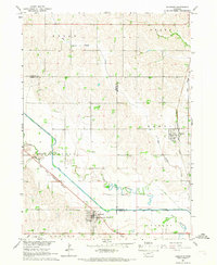
1966 Map of Bancroft
USGS Topo · Published 1968About this map
Bancroft and Rosalie serve as the primary anchors of this mid-1960s survey, situated along the northeastern Nebraska plains where the Omaha Indian Reservation Boundary meets the borders of Cuming, Thurston, and Burt counties. The landscape is defined by the winding course of Logan Creek and the meandering segments of the Old Channel, illustrating the region's complex hydrological history and drainage patterns.
Find a feature on this map
19 named features on this map. Tap any name to fly to it.
Don’t see what you’re looking for? This feature index may not catch every label — zoom into the map to look around manually.
Map Details
Editions of this 1966 Bancroft Map
This is the sole edition of this map. No revisions or reprints were ever made.
Other maps of this area

1955 · Sioux City
USGS Topo · 1:250,000

1955 · Fremont
USGS Topo · 1:250,000

1957 · Fremont
USGS Topo · 1:250,000

1958 · Sioux City
USGS Topo · 1:250,000

1958 · Fremont
USGS Topo · 1:250,000

1959 · Sioux City
USGS Topo · 1:250,000

1966 · West Point NW
USGS Topo · 1:24,000

1966 · Lyons
USGS Topo · 1:24,000

1966 · West Point NE
USGS Topo · 1:24,000

1966 · Walthill SW
USGS Topo · 1:24,000