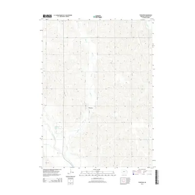
2014 Map of Thurston
USGS Topo · Published 2014About this map
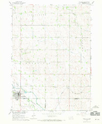
Thurston serves as the central hub of this agricultural landscape, situated where Sand Rd and H Ave intersect. The terrain is defined by a dense network of watercourses, most notably the Middle Cr which meanders southward toward the town. To the southwest, the engineering of the landscape is evident through the Logan Creek Dredge, a straight channel that contrasts sharply with the nearby winding remnants of the Old Channel Logan Creek. This juxtaposition highlights early 20th-century efforts to manage drainage and reclaim land for farming. Smaller tributaries like Cow Cr and Rattlesnake Cr drain the surrounding hills, while the strictly partitioned grid of rural roads, such as C Ave and 21st Rd, underscores the systematic organization of Nebraska's farm country. The map captures a moment in the modern era where natural drainage and human intervention remain visible side-by-side.
Find a feature on this map
26 named features on this map. Tap any name to fly to it.
Don’t see what you’re looking for? This feature index may not catch every label — zoom into the map to look around manually.
Map Details
Editions of this 2014 Thurston Map
This is the sole edition of this map. No revisions or reprints were ever made.
Other maps of this area

1955 · Sioux City
USGS Topo · 1:250,000

1958 · Sioux City
USGS Topo · 1:250,000

1959 · Sioux City
USGS Topo · 1:250,000
1966 · Bancroft
USGS Topo · 1:24,000

1966 · Thurston
USGS Topo · 1:24,000
1966 · Altona SE
USGS Topo · 1:24,000

1966 · Altona NE
USGS Topo · 1:24,000

1966 · Pender NE
USGS Topo · 1:24,000
1966 · Pender
USGS Topo · 1:24,000
1967 · Wakefield
USGS Topo · 1:24,000