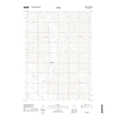
2017 Map of Thurston
USGS Topo · Published 2017About this map
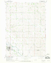
Thurston serves as the central hub of this agricultural landscape in northeastern Nebraska, situated at the intersection of H Ave and 17 Rd. The map illustrates a highly managed hydrological system, most notably the Logan Creek Dredge, which reflects 20th-century efforts to channelize and drain the fertile bottomlands for farming. Traces of the original landscape remain visible through the Old Channel Logan Creek, showing where the waterway once meandered before being straightened. A network of section-line roads, including G Ave, F Ave, and the curiously named The Strip Rd, provides access to the surrounding fields. The terrain is defined by several drainage systems, including Middle Cr, Rattlesnake Cr, and Big Slough Cr, which cut through the uplands to feed into the larger creek valleys.
Find a feature on this map
31 named features on this map. Tap any name to fly to it.
Don’t see what you’re looking for? This feature index may not catch every label — zoom into the map to look around manually.
Map Details
Editions of this 2017 Thurston Map
This is the sole edition of this map. No revisions or reprints were ever made.
Other maps of this area

1955 · Sioux City
USGS Topo · 1:250,000

1958 · Sioux City
USGS Topo · 1:250,000

1959 · Sioux City
USGS Topo · 1:250,000
1966 · Bancroft
USGS Topo · 1:24,000

1966 · Thurston
USGS Topo · 1:24,000
1966 · Altona SE
USGS Topo · 1:24,000

1966 · Altona NE
USGS Topo · 1:24,000

1966 · Pender NE
USGS Topo · 1:24,000
1966 · Pender
USGS Topo · 1:24,000
1967 · Wakefield
USGS Topo · 1:24,000