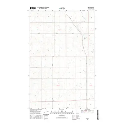
2017 Map of Tiber
USGS Topo · Published 2017About this map
Tiber anchors this northern Montana landscape in Liberty County, situated along a prominent east-west transportation corridor. The terrain is defined by the drainage patterns of Tiber Coulee and Badger Coulee, which carve through the high plains toward the Cottonwood Cr system. This area, surveyed for the National Topographic Map Series, illustrates the rigid geometry of the Public Land Survey System, with township boundaries like t33n r5e and t32n r6e organizing the vast agricultural and grazing land. Local travel is facilitated by a network of section-line roads, including Utopia Rd, Thielman Rd, and the diagonally-trending Whitlash Rd. These routes connect dispersed rural holdings to larger regional arteries, reflecting a landscape where distance and geography dictate the placement of every homestead and water source.
Find a feature on this map
16 named features on this map. Tap any name to fly to it.
Don’t see what you’re looking for? This feature index may not catch every label — zoom into the map to look around manually.
Map Details
Editions of this 2017 Tiber Map
This is the sole edition of this map. No revisions or reprints were ever made.
Other maps of this area

1919 · Alma
USGS Topo · 1:125,000

1954 · Shelby
USGS Topo · 1:250,000

1958 · Shelby
USGS Topo · 1:250,000

1962 · Tiber
USGS Topo · 1:24,000

1962 · Lakey Ranch
USGS Topo · 1:24,000

1962 · North Lothair School
USGS Topo · 1:24,000

1962 · Blair Ranch
USGS Topo · 1:24,000

1963 · Chester NW
USGS Topo · 1:24,000

1963 · Chester
USGS Topo · 1:24,000

1970 · Sagebrush Coulee
USGS Topo · 1:24,000