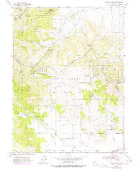
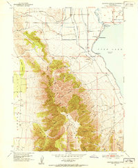
1954 Map of Tickville Spring
USGS Topo · Published 1978About this map
The rugged boundary between Salt Lake and Utah counties is dominated by the Camp Williams State Military Res, a landscape defined by high peaks and strategic training grounds. The terrain transitions from the steep Oquirrh Mountains in the west to the Traverse Mountains in the east, separated by deep drainages like Rose Canyon and Butterfield Canyon. Resource extraction and water management are evident through labels for the Butterfield Tunnel, various tailings, and several prospects scattered along the ridges.
Find a feature on this map
52 named features on this map. Tap any name to fly to it.
Don’t see what you’re looking for? This feature index may not catch every label — zoom into the map to look around manually.
Map Details
Editions of this 1954 Tickville Spring Map
4 editions found
Other maps of this area

1885 · Salt Lake
USGS Topo · 1:250,000

1885 · Tooele Valley
USGS Topo · 1:250,000

1915 · Fairfield
USGS Topo · 1:62,500

1917 · Fairfield
USGS Topo · 1:62,500

1925 · Ft. Douglas
USGS Topo · 1:125,000

1928 · Ft. Douglas
USGS Topo · 1:125,000

1951 · Jordan Narrows
USGS Topo · 1:24,000
1951 · Saratoga Springs
USGS Topo · 1:24,000

1951 · Midvale
USGS Topo · 1:24,000

1952 · Bingham Canyon
USGS Topo · 1:24,000