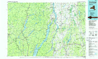
1986 Map of Ticonderoga
USGS Topo · Published 1986About this map
Fort Ticonderoga and Mount Defiance anchor this landscape at the strategic junction where Lake Champlain meets the waters of Lake George. This mid-1980s compilation illustrates the intersection of the Adirondack Park to the west and the Green Mountain National Forest to the east, divided by the New York-Vermont state line. The map highlights the legacy of early defense and industry, from the Mount Independence State Historic Site across the water from Ticonderoga to the Ore Bed located near Brandon.
Find a feature on this map
161 named features on this map. Tap any name to fly to it.
Don’t see what you’re looking for? This feature index may not catch every label — zoom into the map to look around manually.
Map Details
Editions of this 1986 Ticonderoga Map
This is the sole edition of this map. No revisions or reprints were ever made.
Other maps of this area

1891 · Rutland
USGS Topo · 1:62,500

1893 · Wallingford
USGS Topo · 1:62,500

1893 · Rutland
USGS Topo · 1:62,500

1893 · Fort Ann
USGS Topo · 1:62,500

1893 · Whitehall
USGS Topo · 1:62,500

1894 · Elizabethtown
USGS Topo · 1:62,500

1894 · Port Henry
USGS Topo · 1:62,500

1894 · Ticonderoga
USGS Topo · 1:62,500

1894 · Pawlet
USGS Topo · 1:62,500

1895 · Whitehall
USGS Topo · 1:62,500