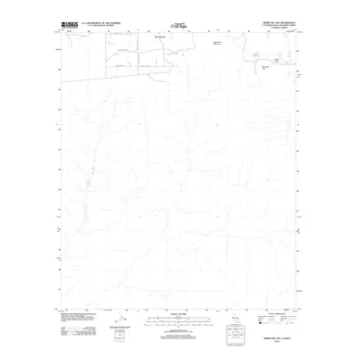
2012 Map of Tierra del Sol
USGS Topo · Published 2012About this map
Tierra del Sol sits at the northern edge of this border region, where a network of rural routes like Moon Valley Rd and Tierra Estrella suggests a landscape of small holdings and desert ranching. The terrain transitions from the residential clusters in the north toward the rugged heights of Rattlesnake Mountain and Boundary Peak. This 2012 survey illustrates the intersection of geography and international boundaries, with Boundary Cr and Jewell Valley cutting through the arid landscape. The presence of Lake Domingo provides a critical water source in a region defined by high-elevation desert scrub and clear topographical relief. Researchers can trace the local road names, such as Alta Vega Rd and Tierra Real Rd, which reflect the cultural heritage and developmental pattern of this high-desert community.
Find a feature on this map
14 named features on this map. Tap any name to fly to it.
Don’t see what you’re looking for? This feature index may not catch every label — zoom into the map to look around manually.
Map Details
Editions of this 2012 Tierra del Sol Map
This is the sole edition of this map. No revisions or reprints were ever made.
Other maps of this area

1931 · Carrizo
USGS Topo · 1:125,000

1939 · Campo
USGS Topo · 1:62,500

1939 · Jacumba
USGS Topo · 1:62,500

1942 · Campo
USGS Topo · 1:62,500

1942 · Jacumba
USGS Topo · 1:62,500

1950 · San Diego
USGS Topo · 1:250,000

1954 · San Diego
USGS Topo · 1:250,000

1955 · San Diego
USGS Topo · 1:250,000

1958 · San Diego
USGS Topo · 1:250,000
1959 · Campo
USGS Topo · 1:24,000