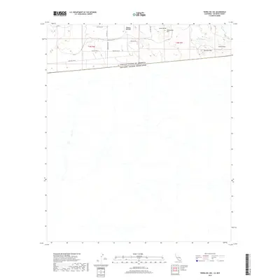
2018 Map of Tierra del Sol
USGS Topo · Published 2018About this map
United States Of America Estados Unidos Mexicanos defines the southern reach of this San Diego County quadrangle, marking the international boundary between California and Baja California. The small community of Tierra del Sol serves as the primary settlement hub, situated just north of the border. To the east, the landscape transitions into the high desert character of Jewell Valley, where the terrain begins to slope toward Boundary Cr.
Find a feature on this map
19 named features on this map. Tap any name to fly to it.
Don’t see what you’re looking for? This feature index may not catch every label — zoom into the map to look around manually.
Map Details
Editions of this 2018 Tierra del Sol Map
This is the sole edition of this map. No revisions or reprints were ever made.
Other maps of this area

1931 · Carrizo
USGS Topo · 1:125,000

1939 · Campo
USGS Topo · 1:62,500

1939 · Jacumba
USGS Topo · 1:62,500

1942 · Campo
USGS Topo · 1:62,500

1942 · Jacumba
USGS Topo · 1:62,500

1950 · San Diego
USGS Topo · 1:250,000

1954 · San Diego
USGS Topo · 1:250,000

1955 · San Diego
USGS Topo · 1:250,000

1958 · San Diego
USGS Topo · 1:250,000
1959 · Campo
USGS Topo · 1:24,000