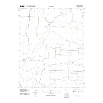
2010 Map of Tiff City
USGS Topo · Published 2010About this map
Tiff City and the surrounding rural landscape of McDonald County sit at the western edge of the Springfield Plain, where the terrain begins to break toward the White River Hills. This 2010 survey details a region defined by its watercourses and family burial grounds, capturing a quiet network of small settlements like Hart and Coy. The drainage patterns of Buffalo Creek, Patterson Creek, and the Elk River dictate the local geography, winding through numerous hollows such as Beeman Hollow and Kinslow Hollow. For those tracing local heritage, the map is remarkably dense with documented burial sites, including Rinehart Cemetery, Price Cemetery, Mannings Chapel Cemetery, and Mitchell Cemetery, providing a precise spatial record of the community's ancestral landmarks. The road network, including the named Hodson Way and Patterson Creek Rd, connects these disparate homesteads and hollows across the Missouri-Oklahoma borderlands.
Find a feature on this map
60 named features on this map. Tap any name to fly to it.
Don’t see what you’re looking for? This feature index may not catch every label — zoom into the map to look around manually.
Map Details
Editions of this 2010 Tiff City Map
This is the sole edition of this map. No revisions or reprints were ever made.
Other maps of this area

1907 · Wyandotte
USGS Topo · 1:125,000

1909 · Wyandotte
USGS Topo · 1:125,000

1916 · Neosho
USGS Topo · 1:62,500

1940 · Noel
USGS Topo · 1:62,500

1943 · Noel
USGS Topo · 1:62,500

1949 · Seneca
USGS Topo · 1:24,000

1950 · Seneca
USGS Topo · 1:24,000

1954 · Tulsa
USGS Topo · 1:250,000

1958 · Tulsa
USGS Topo · 1:250,000

1961 · Wyandotte
USGS Topo · 1:24,000