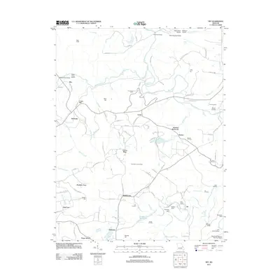
2012 Map of Tiff
USGS Topo · Published 2012About this map
The Big River and its major tributary, Mineral Fork, define the drainage of this Washington County landscape, which is marked by a deep history of extraction and rural community life. Small settlements like Cannon Mines, Baryties, and Fertile hint at the area's geological importance, while the presence of the Thunderbolt CCC Camp reflects early 20th-century conservation and labor history. The map records several smaller community nodes, including Tiff, Shibboleth, and Bellefontaine, often oriented around stream crossings or historic road junctions.
Find a feature on this map
96 named features on this map. Tap any name to fly to it.
Don’t see what you’re looking for? This feature index may not catch every label — zoom into the map to look around manually.
Map Details
Editions of this 2012 Tiff Map
This is the sole edition of this map. No revisions or reprints were ever made.
Other maps of this area

1901 · De Soto
USGS Topo · 1:125,000

1905 · Bonneterre
USGS Topo · 1:62,500

1906 · Potosi
USGS Topo · 1:62,500

1930 · De Soto NE
USGS Topo · 1:24,000

1931 · De Soto SE
USGS Topo · 1:24,000

1937 · Fletcher
USGS Topo · 1:24,000

1937 · Tiff
USGS Topo · 1:24,000

1938 · Fletcher
USGS Topo · 1:24,000

1939 · Tiff
USGS Topo · 1:24,000

1946 · Richwoods
USGS Topo · 1:62,500