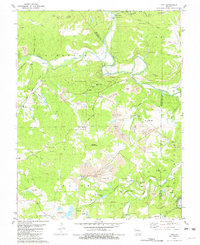
1981 Map of Tiff
USGS Topo · Published 1982About this map
The Big River and Mineral Fork converge in this corner of the Ozarks, a landscape deeply shaped by the mining industry of the late 1970s. Extensive strip mine operations and tailings ponds dominate the terrain, particularly near the settlement of Tiff and along the Missouri Pacific railroad line. Amidst this industrial activity, the map preserves the locations of local landmarks such as Oakland Ch, the Washington Lookout Tower, and numerous family and community burial grounds including St Joseph Cem and Masonic Cem.
Find a feature on this map
77 named features on this map. Tap any name to fly to it.
Don’t see what you’re looking for? This feature index may not catch every label — zoom into the map to look around manually.
Map Details
Editions of this 1981 Tiff Map
This is the sole edition of this map. No revisions or reprints were ever made.
Other maps of this area

1901 · De Soto
USGS Topo · 1:125,000

1905 · Bonneterre
USGS Topo · 1:62,500

1906 · Potosi
USGS Topo · 1:62,500

1930 · De Soto NE
USGS Topo · 1:24,000

1931 · De Soto SE
USGS Topo · 1:24,000

1937 · Fletcher
USGS Topo · 1:24,000

1937 · Tiff
USGS Topo · 1:24,000

1938 · Fletcher
USGS Topo · 1:24,000

1939 · Tiff
USGS Topo · 1:24,000

1946 · Richwoods
USGS Topo · 1:62,500