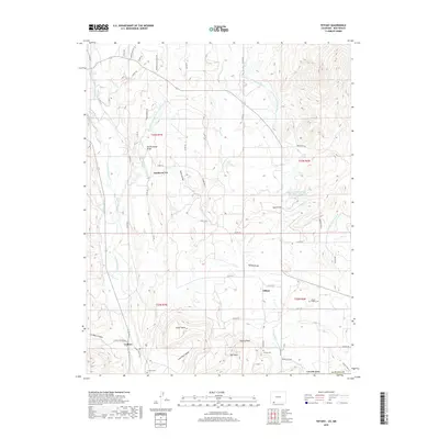
2019 Map of Tiffany
USGS Topo · Published 2019About this map
Tiffany and La Boca center this 2019 survey of the Southern Ute reservation area in La Plata County. The landscape is defined by a sophisticated network of irrigation and water management, including the Pine River Canal, Spring Cr Extension Ditch, and the La Boca Ditch. These waterways support the valley surrounding the Los Pinos River, which carves through the western portion of the map. Elevated landforms such as Shellhammer Ridge, Tunnel Hill, and Tiffany Peak provide a clear view of the topographic transition from the high mesas down to the river bottoms. For genealogists and local historians, the inclusion of Tiffany Cem and La Boca Cem, along with named family-oriented landmarks like Mid Mesa and Indian Mesa, offers a precise record of the community's geographic footprint. The network of county roads, including Co RD 321 and La Boca Ranch RD, connects these scattered settlements across the high-desert terrain.
Find a feature on this map
62 named features on this map. Tap any name to fly to it.
Don’t see what you’re looking for? This feature index may not catch every label — zoom into the map to look around manually.
Map Details
Editions of this 2019 Tiffany Map
This is the sole edition of this map. No revisions or reprints were ever made.
Other maps of this area

1889 · Largo
USGS Topo · 1:250,000

1895 · Largo
USGS Topo · 1:250,000

1908 · Ignacio
USGS Topo · 1:125,000

1924 · Ignacio
USGS Topo · 1:125,000

1924 · Pagosa Springs
USGS Topo · 1:125,000

1927 · Pagosa Springs
USGS Topo · 1:125,000

1945 · Durango
USGS Topo · 1:250,000

1953 · Durango
USGS Topo · 1:250,000

1954 · Durango
USGS Topo · 1:250,000

1954 · Allison
USGS Topo · 1:24,000