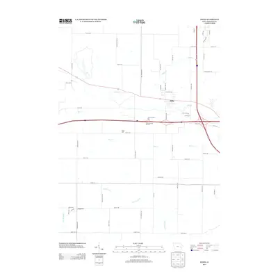
2013 Map of Tiffin
USGS Topo · Published 2013About this map
Tiffin and Cosgrove serve as the primary focal points in this section of Johnson County, where the landscape transitions from established agriculture to increasing modern transportation infrastructure. The map reveals a dense network of watercourses, including Clear Creek, Buffalo Creek, and the curiously named Old Womans Creek, which carve through the Iowa terrain. Significant modern development is anchored by the intersection of major thoroughfares, marked by the presence of the Tiffin West Bound Rest Area and its eastbound counterpart. While much of the land remains divided by a grid of rural roads like Greencasle Ave NW and Half Moon Ave NW, the elevation at Sand Hill provides one of the few named topographical landmarks amidst the winding reaches of Deer Creek and the North Branch of Old Mans Creek.
Find a feature on this map
53 named features on this map. Tap any name to fly to it.
Don’t see what you’re looking for? This feature index may not catch every label — zoom into the map to look around manually.
Map Details
Editions of this 2013 Tiffin Map
This is the sole edition of this map. No revisions or reprints were ever made.
Other maps of this area

1887 · Cedar Rapids
USGS Topo · 1:62,500

1888 · Amana
USGS Topo · 1:62,500

1889 · Amana
USGS Topo · 1:62,500

1891 · Oxford
USGS Topo · 1:62,500

1891 · Cedar Rapids
USGS Topo · 1:62,500

1891 · Iowa City
USGS Topo · 1:62,500

1894 · Oxford
USGS Topo · 1:62,500

1899 · Amana
USGS Topo · 1:62,500

1903 · Fairfax
USGS Topo · 1:125,000

1938 · Iowa City
USGS Topo · 1:62,500