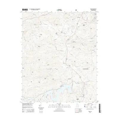
2014 Map of Tiger
USGS Topo · Published 2014About this map
The Tallulah River corridor in Rabun County, Georgia, anchors this 2014 survey, highlighting the distinct communities of Tiger, Wiley, and Lakemont as they follow the historic rail and highway routes southward. The landscape is defined by the significant descent of the river into Lake Rabun and Tallulah Falls Lake, a geography that historically powered the region's early hydroelectric development. The map reveals a high density of family-named landmarks and historical sites, including the Wiley Trestle and several local burial grounds such as Roane Cem and Cruckleton Cem. The northern portion transition into the southern edges of Clayton, while the eastern reaches are bounded by the Chattahoochee National Forest. This modern topo also captures modern utility and recreation sites, from the Flying Ranch Airport to the Athens YMCA Camp Lake, showing the evolution of this mountain landscape from an early industrial river valley to a contemporary residential and recreational hub.
Find a feature on this map
96 named features on this map. Tap any name to fly to it.
Don’t see what you’re looking for? This feature index may not catch every label — zoom into the map to look around manually.
Map Details
Editions of this 2014 Tiger Map
This is the sole edition of this map. No revisions or reprints were ever made.
Other maps of this area

1886 · Dahlonega
USGS Topo · 1:125,000

1886 · Walhalla
USGS Topo · 1:125,000

1892 · Dahlonega
USGS Topo · 1:125,000

1892 · Walhalla
USGS Topo · 1:125,000

1896 · Walhalla
USGS Topo · 1:125,000

1896 · Dahlonega
USGS Topo · 1:125,000

1903 · Dahlonega
USGS Topo · 1:125,000

1935 · Dillard
USGS Topo · 1:24,000

1935 · Rabun Bald
USGS Topo · 1:24,000

1935 · Hightower Bald
USGS Topo · 1:24,000