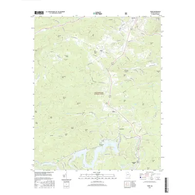
2017 Map of Tiger
USGS Topo · Published 2017About this map
Lake Rabun and the Tallulah River dominate the southern landscape of this Rabun County survey, where the mountain terrain of the Chattahoochee National Forest meets the developed corridors of Clayton and Tiger. The map documents a complex network of ridges including Tiger Mountain, Crunkleton Ridge, and Bee Branch Ridge, alongside several small family burial grounds such as Roane Cemetery and Jameson Cemetery. A notable engineering landmark, the Wiley Trestle, sits near the community of Wiley, while the Big Creek Flying Ranch Airport provides a point of interest for aviation history. The geography here is defined by high peaks like Screamer Mountain and Stroud Mountain overlooking the winding paths of Stekoa Creek and Tiger Creek. This 2017 edition records the modern footprint of settlements like Lakemont and Tallulah Falls at the edge of the Blue Ridge.
Find a feature on this map
113 named features on this map. Tap any name to fly to it.
Don’t see what you’re looking for? This feature index may not catch every label — zoom into the map to look around manually.
Map Details
Editions of this 2017 Tiger Map
This is the sole edition of this map. No revisions or reprints were ever made.
Other maps of this area

1886 · Dahlonega
USGS Topo · 1:125,000

1886 · Walhalla
USGS Topo · 1:125,000

1892 · Dahlonega
USGS Topo · 1:125,000

1892 · Walhalla
USGS Topo · 1:125,000

1896 · Walhalla
USGS Topo · 1:125,000

1896 · Dahlonega
USGS Topo · 1:125,000

1903 · Dahlonega
USGS Topo · 1:125,000

1935 · Dillard
USGS Topo · 1:24,000

1935 · Rabun Bald
USGS Topo · 1:24,000

1935 · Hightower Bald
USGS Topo · 1:24,000