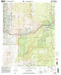
2006 Map of Tijeras
USGS Topo · Published 2007About this map
Tijeras and the high mountain passes of the Sandia Mountains anchor this 2006 revision, where the urban edge of Albuquerque meets the protected reaches of the Cibola National Forest. The map traces the critical transportation corridor along Historic Route 66 as it winds through Tijeras Canyon, a route long defined by the geologic break between the Sandias and the Manzano Mountains. Settlement patterns here reflect a deep history of land use, from the Sandia Pueblo Ruins to the Canon de Carnue Grant.
Find a feature on this map
61 named features on this map. Tap any name to fly to it.
Don’t see what you’re looking for? This feature index may not catch every label — zoom into the map to look around manually.
Map Details
Editions of this 2006 Tijeras Map
This is the sole edition of this map. No revisions or reprints were ever made.
Other maps of this area

1888 · Bernalillo
USGS Topo · 1:125,000

1889 · Albuquerque
USGS Topo · 1:125,000

1892 · San Pedro
USGS Topo · 1:125,000

1893 · Albuquerque
USGS Topo · 1:125,000

1917 · Estancia
USGS Topo · 1:125,000

1934 · Alameda
USGS Topo · 1:24,000

1934 · East Albuquerque
USGS Topo · 1:24,000

1938 · Albuquerque
USGS Topo · 1:62,500

1952 · Hubbell Spring
USGS Topo · 1:24,000

1954 · Sandia Crest
USGS Topo · 1:24,000
Featured Places
- Albuquerque, NM
- Cedar Crest, NM
- Tijeras, NM
- Vista Del Mundo, Albuquerque
- Winterwood Park (HOA), Albuquerque