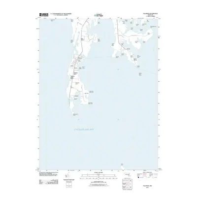
2011 Map of Tilghman
USGS Topo · Published 2011About this map
Tilghman Island dominates this maritime landscape of the Maryland Eastern Shore, connected to the mainland by a narrow bridge at Deep Harbor. The island's culture is centered on the settlements of Tilghman, Avalon, and Fairbank, where the proximity to Chesapeake Bay has long defined local life. Important community landmarks such as the Tilghman Island Cemetery and Saint Johns Cemetery provide touchpoints for local family history. To the east, the peninsula across Harris Creek features the community of Neavitt, complete with its own Neavitt Post Office. The map captures a complex shoreline of points and necks, from Blackwalnut Point in the south to the marshy reaches of Seth Point and Turkey Neck Point. These geographic features, along with landings like Avalon Island Landing, reflect the area's enduring reliance on the water for transport and recreation.
Find a feature on this map
62 named features on this map. Tap any name to fly to it.
Don’t see what you’re looking for? This feature index may not catch every label — zoom into the map to look around manually.
Map Details
Editions of this 2011 Tilghman Map
This is the sole edition of this map. No revisions or reprints were ever made.
Other maps of this area

1892 · Annapolis
USGS Topo · 1:62,500

1893 · Sharps Island
USGS Topo · 1:62,500

1898 · Choptank
USGS Topo · 1:125,000

1904 · St. Michaels
USGS Topo · 1:62,500

1904 · Annapolis
USGS Topo · 1:62,500

1904 · Sharps Island
USGS Topo · 1:62,500

1904 · Oxford
USGS Topo · 1:62,500

1908 · Choptank
USGS Topo · 1:125,000

1942 · Tilghman
USGS Topo · 1:31,680

1942 · Oxford
USGS Topo · 1:31,680