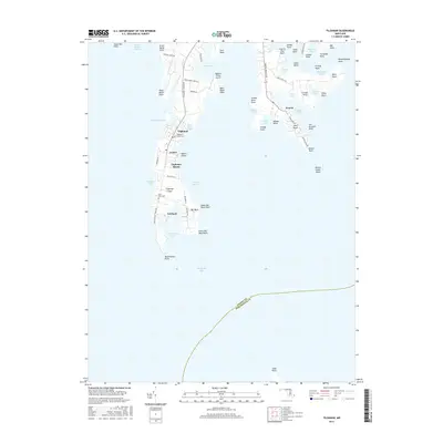
2016 Map of Tilghman
USGS Topo · Published 2016About this map
Tilghman Island dominates this coastal survey, defined by its intricate shoreline of coves and narrows along the Chesapeake Bay. The map records the tight-knit settlement patterns of Tilghman, Avalon, and Fairbank, where life is oriented toward the water at Dogwood Harbor and Knapps Narrows. Local history is preserved in the location of the Tilghman Island Cem and Saint Johns Cem, while the inclusion of the Tilghman Whipp Airport and a network of local roads like Tilghman Island Rd shows the modern infrastructure supporting these maritime communities. Across the water to the east, the neck around Neavitt is deeply feathered by tidal creeks, including Balls Creek and Long Cove, illustrating the Chesapeake's characteristic jagged geography of points and marshes such as Amys Marsh Point and Blackwalnut Point.
Find a feature on this map
73 named features on this map. Tap any name to fly to it.
Don’t see what you’re looking for? This feature index may not catch every label — zoom into the map to look around manually.
Map Details
Editions of this 2016 Tilghman Map
This is the sole edition of this map. No revisions or reprints were ever made.
Other maps of this area

1892 · Annapolis
USGS Topo · 1:62,500

1893 · Sharps Island
USGS Topo · 1:62,500

1898 · Choptank
USGS Topo · 1:125,000

1904 · St. Michaels
USGS Topo · 1:62,500

1904 · Annapolis
USGS Topo · 1:62,500

1904 · Sharps Island
USGS Topo · 1:62,500

1904 · Oxford
USGS Topo · 1:62,500

1908 · Choptank
USGS Topo · 1:125,000

1942 · Tilghman
USGS Topo · 1:31,680

1942 · Oxford
USGS Topo · 1:31,680