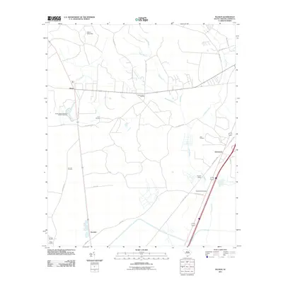
2011 Map of Tillman
USGS Topo · Published 2011About this map
Tillman and Switzerland anchor this landscape in Jasper County, defined by a complex network of waterways including the Great Swamp and Broad Water. The geography reflects a region shaped by its low-lying hydrology, where Wagon Branch and Sand Branch thread between scattered homesteads and small settlements. In the northwest, the evocative Hectic Savannas represent a distinct terrain type typical of the Lowcountry wetlands.
Find a feature on this map
33 named features on this map. Tap any name to fly to it.
Don’t see what you’re looking for? This feature index may not catch every label — zoom into the map to look around manually.
Map Details
Editions of this 2011 Tillman Map
This is the sole edition of this map. No revisions or reprints were ever made.
Other maps of this area

1918 · Yemassee
USGS Topo · 1:62,500

1919 · Pineland
USGS Topo · 1:62,500

1920 · Hardeeville
USGS Topo · 1:62,500

1920 · Okatie
USGS Topo · 1:62,500

1942 · Okatie
USGS Topo · 1:62,500

1943 · Pineland
USGS Topo · 1:62,500

1943 · Hardeeville
USGS Topo · 1:62,500

1943 · Yemassee
USGS Topo · 1:62,500

1947 · Savannah
USGS Topo · 1:250,000

1948 · Savannah
USGS Topo · 1:250,000