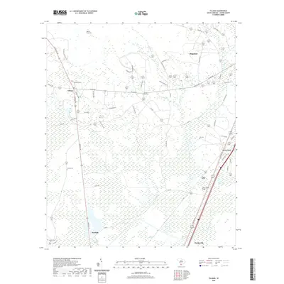
2020 Map of Tillman
USGS Topo · Published 2020About this map
Hectic Savannas and the expansive Great Swamp dominate this Jasper County landscape, illustrating the intricate wetland network that defines the South Carolina Lowcountry. The map details a transition from the dense marshes of Green Swamp and Darn Swamp to the upland settlements of Tillman and Switzerland. Family history is deeply etched into the geography here, with numerous burial grounds such as Mew Cem, Porter Cem, and Arm Oak Cem scattered among the rural holdings. Transport through the damp terrain is facilitated by structures like Wiggins Bridge and Great Swamp Bridge, which span the watercourses that once governed local movement. The road network, including the aptly named Whistle Stop Rd and Dark Horse Trl, suggests a history of small-scale agriculture and timbering integrated into the swampy environment.
Find a feature on this map
64 named features on this map. Tap any name to fly to it.
Don’t see what you’re looking for? This feature index may not catch every label — zoom into the map to look around manually.
Map Details
Editions of this 2020 Tillman Map
This is the sole edition of this map. No revisions or reprints were ever made.
Other maps of this area

1918 · Yemassee
USGS Topo · 1:62,500

1919 · Pineland
USGS Topo · 1:62,500

1920 · Hardeeville
USGS Topo · 1:62,500

1920 · Okatie
USGS Topo · 1:62,500

1942 · Okatie
USGS Topo · 1:62,500

1943 · Pineland
USGS Topo · 1:62,500

1943 · Hardeeville
USGS Topo · 1:62,500

1943 · Yemassee
USGS Topo · 1:62,500

1947 · Savannah
USGS Topo · 1:250,000

1948 · Savannah
USGS Topo · 1:250,000