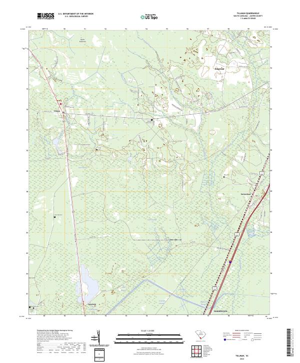
2024 Map of Tillman
USGS Topo · Published 2024About this map
Hectic Savannas and the vast wetland networks of the Lowcountry define this Jasper County landscape. The area is characterized by an intricate drainage system where Sand Branch, Wagon Branch, and Broad Water feed into massive alluvial features such as Great Swamp and Green Swamp. These natural boundaries have historically shaped local settlement patterns, concentrating towns like Tillman and Ridgeland along higher ground and transport corridors.
Find a feature on this map
63 named features on this map. Tap any name to fly to it.
Don’t see what you’re looking for? This feature index may not catch every label — zoom into the map to look around manually.
Map Details
Editions of this 2024 Tillman Map
This is the sole edition of this map. No revisions or reprints were ever made.
Other maps of this area

1918 · Yemassee
USGS Topo · 1:62,500

1919 · Pineland
USGS Topo · 1:62,500

1920 · Hardeeville
USGS Topo · 1:62,500

1920 · Okatie
USGS Topo · 1:62,500

1942 · Okatie
USGS Topo · 1:62,500

1943 · Pineland
USGS Topo · 1:62,500

1943 · Hardeeville
USGS Topo · 1:62,500

1943 · Yemassee
USGS Topo · 1:62,500

1947 · Savannah
USGS Topo · 1:250,000

1948 · Savannah
USGS Topo · 1:250,000