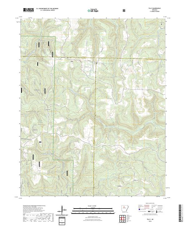
2024 Map of Tilly
USGS Topo · Published 2024About this map
Union Hill Cem and Parks Cem stand as quiet landmarks in this highland region where the borders of Pope, Searcy, and Van Buren counties converge. The small settlement of Tilly serves as a local hub near the headwaters of Archey Creek and Bear Creek. The terrain is characterized by a series of prominent rises and deep drainages, including Walker Mtn, Shields Knob, and Alread Hill.
Find a feature on this map
63 named features on this map. Tap any name to fly to it.
Don’t see what you’re looking for? This feature index may not catch every label — zoom into the map to look around manually.
Map Details
Editions of this 2024 Tilly Map
This is the sole edition of this map. No revisions or reprints were ever made.
Other maps of this area

1879 · Washington
USGS Topo · 1:62,500

1887 · Smyrna
USGS Topo · 1:62,500

1889 · Marshall #3
USGS Topo · 1:62,500

1892 · Marshall
USGS Topo · 1:125,000

1894 · Marshall
USGS Topo · 1:125,000

1901 · Marshall
USGS Topo · 1:125,000

1939 · Snowball
USGS Topo · 1:62,500

1940 · Smyrna
USGS Topo · 1:62,500

1941 · Snowball
USGS Topo · 1:62,500

1942 · Snowball
USGS Topo · 1:62,500