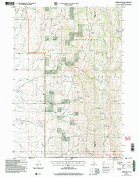
2001 Map of Timber Butte
USGS Topo · Published 2006About this map
The high-desert terrain of the Sawtooth National Forest along the Idaho-Nevada border is defined here by its complex hydrologic network and prominent ridges. Rising above the landscape, Timber Butte stands as a central landmark, while the long expanse of Deadline Ridge runs north-south, dividing the drainage basins. The map reveals a reliance on isolated water sources for ranching or travel, documented through numerous named springs such as Van Eaton Spring, Japanese Spring, and Box Canyon Spring.
Find a feature on this map
58 named features on this map. Tap any name to fly to it.
Don’t see what you’re looking for? This feature index may not catch every label — zoom into the map to look around manually.
Map Details
Editions of this 2001 Timber Butte Map
This is the sole edition of this map. No revisions or reprints were ever made.
Other maps of this area

1955 · Twin Falls
USGS Topo · 1:250,000

1955 · Wells
USGS Topo · 1:250,000

1958 · Wells
USGS Topo · 1:250,000

1958 · Twin Falls
USGS Topo · 1:250,000

1961 · Wells
USGS Topo · 1:250,000

1961 · Gollaher Mountain
USGS Topo · 1:62,500

1961 · Goose Creek
USGS Topo · 1:62,500

1977 · Timber Butte
USGS Topo · 1:24,000

1977 · Big Creek Ranch
USGS Topo · 1:24,000

1977 · Mahogany Butte
USGS Topo · 1:24,000