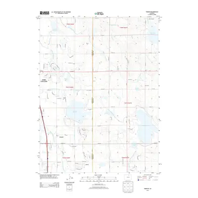
2013 Map of Timnath
USGS Topo · Published 2013About this map
The Cache la Poudre River flows through a landscape defined by an intricate network of irrigation engineering on this Larimer and Weld County border. The town of Timnath serves as a central hub, flanked by the massive Timnath Reservoir and surrounded by a system of ditches including the Eaton Ditch and Poudre Valley Canal. This water management infrastructure supported the agricultural development of the High Plains, evidenced by the presence of Dycrest Dairy and the Kluver settlement. Near the river, the Timnath-Reservoir-Outlet and Lake Canal weave through the terrain, while the Timnath Cem and local Post Office ground the community's history. To the south, the settlement of Kerns and the WKR Airport reflect the area's continued growth along the SE Frontage Rd corridor, where modern suburban expansion begins to meet the established reservoir and canal systems.
Find a feature on this map
77 named features on this map. Tap any name to fly to it.
Don’t see what you’re looking for? This feature index may not catch every label — zoom into the map to look around manually.
Map Details
Editions of this 2013 Timnath Map
This is the sole edition of this map. No revisions or reprints were ever made.
Other maps of this area

1902 · Greeley
USGS Topo · 1:125,000

1906 · Loveland
USGS Topo · 1:62,500

1906 · Fort Collins
USGS Topo · 1:62,500

1907 · Livermore
USGS Topo · 1:125,000

1908 · Loveland
USGS Topo · 1:62,500

1908 · Fort Collins
USGS Topo · 1:62,500

1908 · Eaton
USGS Topo · 1:125,000

1909 · Livermore
USGS Topo · 1:125,000

1910 · Eaton
USGS Topo · 1:125,000

1950 · Windsor
USGS Topo · 1:24,000