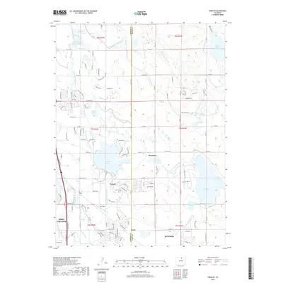
2019 Map of Timnath
USGS Topo · Published 2019About this map
Timnath and Severance sit at the center of an intricate agricultural and water management network along the Larimer and Weld County border. This modern survey illustrates the expansive irrigation infrastructure that defines the region, from the Larimer County Canal in the north to the Lake Canal and Eaton Ditch snaking across the landscape. Large-scale water storage is a dominant feature, with massive impoundments like Windsor Reservoir, Timnath Reservoir, and the Black Hollow Reservoir providing critical resources for the surrounding farms.
Find a feature on this map
61 named features on this map. Tap any name to fly to it.
Don’t see what you’re looking for? This feature index may not catch every label — zoom into the map to look around manually.
Map Details
Editions of this 2019 Timnath Map
This is the sole edition of this map. No revisions or reprints were ever made.
Other maps of this area

1902 · Greeley
USGS Topo · 1:125,000

1906 · Loveland
USGS Topo · 1:62,500

1906 · Fort Collins
USGS Topo · 1:62,500

1907 · Livermore
USGS Topo · 1:125,000

1908 · Loveland
USGS Topo · 1:62,500

1908 · Fort Collins
USGS Topo · 1:62,500

1908 · Eaton
USGS Topo · 1:125,000

1909 · Livermore
USGS Topo · 1:125,000

1910 · Eaton
USGS Topo · 1:125,000

1950 · Windsor
USGS Topo · 1:24,000