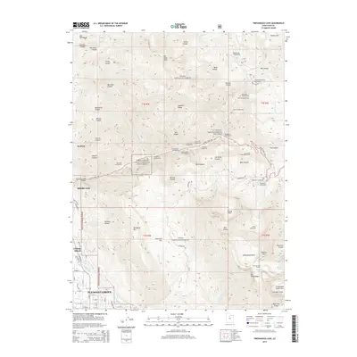
2014 Map of Timpanogos Cave
USGS Topo · Published 2014About this map
The Timpanogos Cave National Monument serves as the focal point of this survey, set within the steep canyons of the Wasatch Range. The map illustrates the transition from the suburban edge of Pleasant Grove, Alpine, and Cedar Hills into the protected wilderness of the Uinta National Forest. The complex geography of American Fork Canyon is detailed with numerous public sites, including the Hanging Rock Picnic Ground and the Tibble Fork Summer Home Area. High-altitude features such as Emerald Lake and the Giant Staircase reveal the glaciated terrain above the tree line. Significant water infrastructure is visible in the valley below, notably the Murdock Canal and Union Canal, which support the agricultural and residential growth of the surrounding communities.
Find a feature on this map
97 named features on this map. Tap any name to fly to it.
Don’t see what you’re looking for? This feature index may not catch every label — zoom into the map to look around manually.
Map Details
Editions of this 2014 Timpanogos Cave Map
This is the sole edition of this map. No revisions or reprints were ever made.
Other maps of this area

1885 · Salt Lake
USGS Topo · 1:250,000

1925 · Ft. Douglas
USGS Topo · 1:125,000

1928 · Ft. Douglas
USGS Topo · 1:125,000

1948 · Timpanogos Cave
USGS Topo · 1:24,000

1948 · Orem
USGS Topo · 1:24,000

1948 · Orem
USGS Topo · 1:62,500

1948 · Aspen Grove
USGS Topo · 1:24,000

1948 · Bridal Veil Falls
USGS Topo · 1:24,000

1950 · Orem
USGS Topo · 1:24,000

1950 · Aspen Grove
USGS Topo · 1:24,000