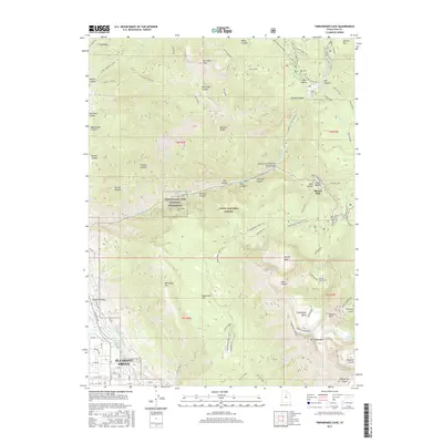
2017 Map of Timpanogos Cave
USGS Topo · Published 2017About this map
The town of Pleasant Grove occupies the southwestern corner of this survey, where the valley floor meets the steep rise of the Wasatch Range. Water management infrastructure, including the Murdoch Canal and North Union Canal, follows the base of the mountains to capture runoff from the high basins above. High-altitude hydrology is further defined by Silver Lake Flat and the Tibble Fork Reservoir, which feed into American Fork as it winds through deep canyons. Within the Uinta National Forest, the Timpanogos Cave National Monument protects subterranean features accessed via the steep Cave Trail. The landscape is a complex of glacial cirques and peaks, from the Giant Staircase to the massive Mount Timpanogos, where Emerald Lake sits high above the timberline.
Find a feature on this map
85 named features on this map. Tap any name to fly to it.
Don’t see what you’re looking for? This feature index may not catch every label — zoom into the map to look around manually.
Map Details
Editions of this 2017 Timpanogos Cave Map
This is the sole edition of this map. No revisions or reprints were ever made.
Other maps of this area

1885 · Salt Lake
USGS Topo · 1:250,000

1925 · Ft. Douglas
USGS Topo · 1:125,000

1928 · Ft. Douglas
USGS Topo · 1:125,000

1948 · Timpanogos Cave
USGS Topo · 1:24,000

1948 · Orem
USGS Topo · 1:24,000

1948 · Orem
USGS Topo · 1:62,500

1948 · Aspen Grove
USGS Topo · 1:24,000

1948 · Bridal Veil Falls
USGS Topo · 1:24,000

1950 · Orem
USGS Topo · 1:24,000

1950 · Aspen Grove
USGS Topo · 1:24,000