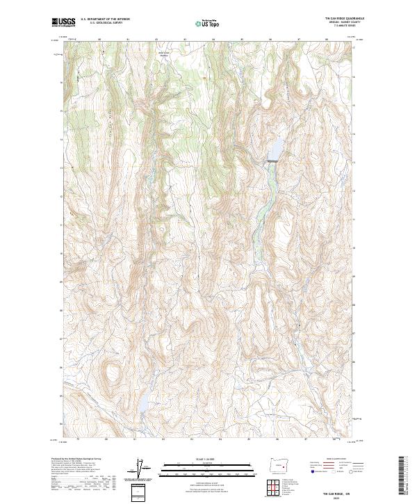
2023 Map of Tin Can Ridge
USGS Topo · Published 2023About this map
Tin Can Ridge dominates this high-desert landscape of Harney County, where the terrain is defined by a series of north-south canyons and drainage systems. Water sources are the critical landmarks in this arid environment, represented by the Tin Can Spring, Cold Spring, and the seasonally significant Alder Creek Meadow. The mapping reveals a sparse but vital transportation network at the southern edge, where Riverside Rd and Crane-Venator Rd navigate the lowlands near Crane Creek.
Find a feature on this map
18 named features on this map. Tap any name to fly to it.
Don’t see what you’re looking for? This feature index may not catch every label — zoom into the map to look around manually.
Map Details
Editions of this 2023 Tin Can Ridge Map
This is the sole edition of this map. No revisions or reprints were ever made.
Other maps of this area

1955 · Burns
USGS Topo · 1:250,000

1958 · Burns
USGS Topo · 1:250,000

1959 · Burns
USGS Topo · 1:250,000

1960 · Crane
USGS Topo · 1:62,500

1968 · Venator
USGS Topo · 1:62,500

1972 · Circle Bar
USGS Topo · 1:24,000

1972 · Venator
USGS Topo · 1:24,000
1972 · Dunnean
USGS Topo · 1:24,000
1972 · Tin Can Ridge
USGS Topo · 1:24,000

1973 · Mahon Creek
USGS Topo · 1:24,000